Showing posts with label hiking. Show all posts
Showing posts with label hiking. Show all posts
Friday, July 5, 2013


Tuesday, August 14, 2012
Check out a great hike on Trail 403
Friday, October 14, 2011
Capitol Peak, Elk Mountains: 14,130 feet
Capitol Peak is west of Aspen, within the Maroon Bells-Snowmass Wilderness and is a 14,130 foot peak in the Northeastern Ridge of the Elk Mountains. Capitol Peak is one of the most difficult of the Colorado 14ers to climb, rating a Class 4 with a level 5 Exposure, meaning that it is dangerous and requires careful, technical moves to navigate the trail; a fall would likely be fatal, and there are big and sheer drops.
 Capitol Peak has an elevation gain of 5,300 feet, and a final elevation of 14,130 feet. The peak can be accessed through the Capitol Creek trailhead, which is a rough 2WD road, although 4WD is needed in early summer because of the steep hills.
The ridge here is considered a "knife-edge ridge" and is mostly completed as an over-night mountaineering experience with camping at Capitol Lake!

The ridge here is considered a "knife-edge ridge" and is mostly completed as an over-night mountaineering experience with camping at Capitol Lake!
Wednesday, October 12, 2011
Pyramid Peak, Elk Mt Range: 14,013 ft
Pyramid Peak is a 14,018 foot peak in the Northeast Ridge of the Elk Mountains. The summit is called Pyramid peak because it resembles a ragged square pyramid and is visible from a valley north of Aspen along the canyon of Maroon Creek. This peak has an elevation gain of 4,500 feet and begins at the Maroon Lake trailhead.
 The peak has steep slopes, loose rock, and exposed ledges, putting it in the Class 4 "technical" peak category. The round-trip length from trailhead to the summit and back is 8 miles.
 The exposure of Pyramid Peak is rated as 4/6, meaning that there is a more serious exposure that could result in serious injury if you fall. Moving past many areas will require some scrambling or short technical moves.
Good Luck on your Hiking Adventures!


Good Luck on your Hiking Adventures!
Monday, October 10, 2011
Maroon Bells Peaks, Elk Mountain Range: 14,156 and 14,014 feet
 The Maroon Bells are two peaks in the Elk Mountains, Maroon Peak and North Maroon Peak. Their peaks are 14,156 and 14,014 feet, and they are 1/3 mile apart and 12 miles southwest of Aspen. Both peaks have an elevation gain of 4,500-4,800 feet, and both are accessed by the Maroon Lake trailhead.
 The different between Maroon Peak and North Maroon Peak is the difficulty of the climbs. Maroon Peak has a difficulty of Class 3 and a 4/6 exposure, meaning a pretty serious exposure that could result in serious injury if you fell,hiking past the area will require some scrambling or short technical moves.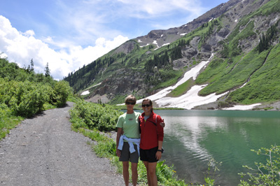

Saturday, October 8, 2011
Snowmass Mountain, Elk Range: 14,092 feet
Snowmass Mountain is a summit along the East Slope in the Elk Mountains off the Snowmass Creek trailhead. Snowmass is a Class 3 with Moderate Exposure along the immediate route, avoidable with some slow hiking or scrambling. It is located within the Maroon Bells-Snowmass Wilderness of the White River National Forest.
 The elevation of Snowmass Mountain is 14,092 feet, and the elevation gain is 5,800 feet. The trailhead is easy-access at Snowmass Creek and is part paved and part dirt. The round trip hike to the summit and back to the trailhead is 21.5 miles and is a nearly year-round alpine snow-climb ascent.


Note: this hike is usually done as an over-nighter.
Thursday, October 6, 2011
Castle Peak, Elk Mountain Range: 14,265 feet
Castle Peak is the highest peak in the Elk Mountains at 14,265 feet, and the 12th highest peak in Colorado. It is on the Northeast Ridge of the Elk Mountains and is classified as a difficult level 2, and is an ideal beginner 14er that has an exciting and breathtaking summit ridge.
 The exposure is a 3/6, meaning that there is a moderate level of exposure on the immediate route and some slow hiking or scrambling may be necessary on the trail. The length of the trail to the summit and back is 13 miles if you start at the main trailhead, 6.5 miles if you start hiking from 11,200 feet, although you must have a 4WD vehicle to park this high up on the mountain.


The elevation gain is 4,600' if you start at the main trailhead, 3,100 feet if you start at 11,200 feet. The Castle Creek trailhead is found by following Castle Creek Road out of Aspen. The trailhead follows a 2WD paved access to 9,750 feet, a rough 2WD access to 9,900 feet, a 4WD access to 12,800 feet by following Castle Creek up past the Montezuma Mine and into a basin north of Castle Peak.
Tuesday, October 4, 2011
Mt Yale, Sawatch Range: 14,196 feet
Mount Yale is a summit along the Southwest Slopes of the Sawatch Mountain Range. Mt. Yale is a Class 2 with Mild Exposure, climbing must be a bit more careful and concentrated close to the route and there are fewer route options.
Class 2 means more difficult hiking than class 1, and some hiking may be off the trail.

 The round trip hike to the summit and back to the trailhead is 9.5 miles. The total elevation gain is 4,300 feet and the summit elevation is 14,196 feet, and the main trailhead is a paved road called Denny Creek Trailhead.
Class 2 means more difficult hiking than class 1, and some hiking may be off the trail.

 The round trip hike to the summit and back to the trailhead is 9.5 miles. The total elevation gain is 4,300 feet and the summit elevation is 14,196 feet, and the main trailhead is a paved road called Denny Creek Trailhead.
Sunday, October 2, 2011
Missouri Mountain, Sawatch Range: 14,067 ft.
Missouri Mountain is a peak with a 14,067 foot elevation with its trailhead at the Missouri Gulch, and it is part of the Sawatch Mountain Range. Missouri Mountain is a Class 2 with Moderate Exposure, climbing must be more careful and concentrated on the immediate route that can be avoidable with slow hiking or scrambling.
 The round trip length to the summit and back is 10.5 miles.
The total elevation gain is 4,500 feet and the summit elevation is 14,067 feet, and the main trailhead is the Missouri Gulch Trailhead, a 2WD dirt road. This road is closed 4 miles below the trailhead, at 9,200 feet during winter.


The total elevation gain is 4,500 feet and the summit elevation is 14,067 feet, and the main trailhead is the Missouri Gulch Trailhead, a 2WD dirt road. This road is closed 4 miles below the trailhead, at 9,200 feet during winter.

Friday, September 30, 2011
Mount Columbia, Sawatch Range: 14,073 feet
Mount Columbia is a summit along the West Slopes from the North Cottonwood Creek trailhead of the Sawatch Mountain Range. Mt. Columbia is a Class 2 with Mild Exposure, climbing must be more careful and concentrated very close to the route with fewer route options. Class 2 is a more difficult hiking than class 1, and some hiking may be off the trail.
 The round trip hike to the summit and back to the trailhead is 11.5 miles. Access to the trailhead is moderately difficult, a rough 2WD dirt road, that may require 4WD in early summer. The road is also closed 3 miles below the trailhead, at 9,200 feet in the winter.


The elevation gain of the peak from the trailhead to the peak is 4,250 feet, and the round-trip length of the trail is 11.5 miles.
Wednesday, September 28, 2011
Mt Oxford, Sawatch Range:14,153 feet
Mount Oxford is a summit connected to Mount Belford with its trailhead at the Missouri Gulch, and it is part of the Sawatch Mountain Range. Oxford is a Class 2 with Mild Exposure, climbing must be more careful and concentrated close to the route with fewer route options and some off-trail hiking.
 The round trip length to the summit and back is 11 miles.


The total elevation gain is 5,800 feet and the summit elevation is 14,153 feet, and the main trailhead is the Missouri Gulch Trailhead, a 2WD dirt road. This road is closed 4 miles below the trailhead, at 9,200 feet during winter.

Tuesday, September 27, 2011
My New Favorite Hike- Lost Lake
Hike Lost Lake to 3 beautiful lakes!
 3 miles of the most beaultiful vistas and views of mountains and lakes - 3 lakes, Lost Lake Slough, Lost Lake, and Dollar Lake. Unbelievable beauty.
3 miles of the most beaultiful vistas and views of mountains and lakes - 3 lakes, Lost Lake Slough, Lost Lake, and Dollar Lake. Unbelievable beauty.Despite the name, you won't get lost. Go to CB, and take Whiterock out towards Irwin Lake.  Where the road splits off to Irwin, take a left on Kebler. Keep going, and enjoy the view! when the aspens are all around you in a close woods for awhile, Lost Lake Campground will come up on the left, after Horseranch turnoff.Turn in and keep to the right and park as far as you can. It takes 35 minutes from CB to drive there.
Where the road splits off to Irwin, take a left on Kebler. Keep going, and enjoy the view! when the aspens are all around you in a close woods for awhile, Lost Lake Campground will come up on the left, after Horseranch turnoff.Turn in and keep to the right and park as far as you can. It takes 35 minutes from CB to drive there. Mountain Biking the Dyke Trail
 Or.... where I learned I am a beginner-intermediate mountain biker, not an expert! Ouch! Ouch! Boom. The entrance to the Dyke trail is just above Irwin Lake on the left - don't go too far or you get to private land. This bike trail goes gently down for 5 miles.
 Have a non-biker drive to Horseranch to pick you up, as that is where the trail ends.  However, an "easy" hiking trail can be an "expert" biking trail. And that's the case here. Rocks, branches, ups and downs. Easy walking, hard biking.
However, an "easy" hiking trail can be an "expert" biking trail. And that's the case here. Rocks, branches, ups and downs. Easy walking, hard biking. Monday, September 26, 2011
Mt Belford, Sawatch Range: 14,197 feet
Mount Belford is a summit along the Northwest Ridge from the Missouri Gulch trailhead of the Sawatch Mountain Range. Mt. Belford is a Class 2 with Mild Exposure that is not along the immediate route, but in the area. Class 2 is a bit more difficult hiking than class 1, and some hiking may be off the trail.
The round trip hike to the summit and back to the trailhead is 8 miles.

 Mount Princeton is an Intermediate Skiing decent, it is rated:
D4 (slopes around 30 degrees, similar to an easier "Expert" run at a resort);
R2 (slightly more inherent danger than average backcountry ski routes);
Grade II (how long it takes to complete in average conditions- half a day).
The total elevation gain is 4,500 feet and the summit elevation is 14,197 feet, and the main trailhead is the Missouri Gulch Trailhead, a 2WD dirt road.
This road is closed 4 miles below the trailhead, at 9,200 feet during winter.
The round trip hike to the summit and back to the trailhead is 8 miles.


D4 (slopes around 30 degrees, similar to an easier "Expert" run at a resort);
R2 (slightly more inherent danger than average backcountry ski routes);
Grade II (how long it takes to complete in average conditions- half a day).
The total elevation gain is 4,500 feet and the summit elevation is 14,197 feet, and the main trailhead is the Missouri Gulch Trailhead, a 2WD dirt road.
This road is closed 4 miles below the trailhead, at 9,200 feet during winter.
Saturday, September 24, 2011
Mount Princeton, Sawatch Range: 14,197 feet
Mount Princeton is a summit along the East Slopes from the Mt. Princeton Road trailhead of the Sawatch Mountain Range. Mt. Princeton is a Class 2 with Mild Exposure, exposure measures how careful and concentrated your climbing must be, very close to the route with fewer route options.
Class 2 means more difficult hiking than class 1, and some hiking may be off the trail.
 Mount Princeton is an Advanced Skiing decent, it is rated:
D7 (slopes around 40 degrees, few terrain obstacles such as trees and cliffs);
R2 (slightly more inherent danger than average backcountry ski routes);
Grade II (how long it takes to complete in average conditions- half a day).

Class 2 means more difficult hiking than class 1, and some hiking may be off the trail.

D7 (slopes around 40 degrees, few terrain obstacles such as trees and cliffs);
R2 (slightly more inherent danger than average backcountry ski routes);
Grade II (how long it takes to complete in average conditions- half a day).

The total elevation gain is 5,400 feet and the summit elevation is 14,197 feet, and the main trailhead is near the town of Nathrop near the Mt. Princeton Road.
The round trip hike to the summit and back to the trailhead is 13 miles if you start at the main trailhead (8,900'), 6.25 miles if you start near 11,000' on the road.
Tuesday, September 20, 2011
Mt. Elbert, Sawatch Range: 14,433 feet
Mount Elbert is a summit along the Northeast Ridge route of the Sawatch Mountain Range. It's considered a Class 1 with Mild Exposure, not along the immediate route, but in the area. Class 1 means easy hiking, usually on a trail.
The round trip hike to the summit and back to the trailhead is 9 miles.
 The total elevation gain is 4,700 feet and the summit elevation is 14,433 feet. The trailhead is near Leadville at North Elbert and begins at an elevation of 10,040 feet.

The round trip hike to the summit and back to the trailhead is 9 miles.


Colorado 14ers
14er- a mountain with an elevation above 14,000 feet.
Colorado contains 54 14ers, or 77% of the 14ers on the mainland United States, making it the highest state in the US.
Colorado contains 54 14ers, or 77% of the 14ers on the mainland United States, making it the highest state in the US.
In the next series of blogs, I will be talking about different 14ers in Colorado's Elk Mountain Range and surrounding areas and ranking them based on their difficulty.
Sunday, August 28, 2011
New Lupine Trail
 The new Lupine Trail! The new Lupine Trail!A brand new singletrack built by CBMBA and close to 200 volunteers last June. Watch the video and ride it virtually! Access it from the Saddle Ridge subdivision culdesac off Gothic Road. Absolutely no parking!! Best accessed from Upper Loop, ride down the bike path and down a short bit from Washington Gulch toward town. Turn right or northwest into Saddle Ridge. The trail ends on Smith Hill Road, turn left and downhill to Slate River Road. |
Friday, July 22, 2011
Wednesdays at Western: Photography Workshop and Day Hike-- August 3, 2011
 Join Allan Ivy from 6am - 2pm on a moderate theww mile round-trip day hike and photography workshop in the mountains around Gunnison to learn the challenges of backcountry photography, including composition, lighting, and camera care!
No hiking experience is necessary, although you must be able to walk 3 miles on an up-ascending trail at a 9,000 foot elevation!
Visit Wednesdays at Western for more details!
Subscribe to:
Posts (Atom)